What exactly is UAV Remote Sensing?
- Brad
- Jun 6, 2023
- 2 min read
Updated: Oct 18, 2023
Understanding UAV Remote Sensing: Revolutionizing Data Collection from Above
Introduction: Unmanned Aerial Vehicles (UAVs), commonly known as drones, have rapidly transformed various industries by offering innovative and efficient solutions. One such application is UAV remote sensing, which has revolutionized data collection and analysis. In this article, we will delve into the world of UAV remote sensing, exploring its definition, applications, and the benefits it brings to fields such as agriculture, environmental monitoring, and infrastructure management.
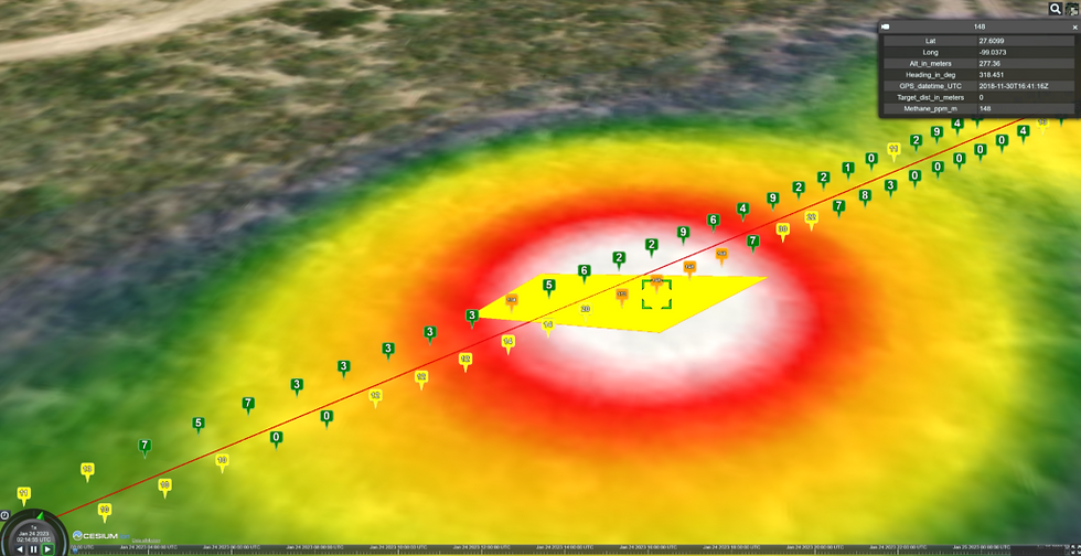
What is UAV Remote Sensing? UAV remote sensing refers to the utilization of unmanned aerial vehicles equipped with various sensors to collect data from the Earth's surface or atmosphere. These sensors capture images, thermal data, multispectral and hyperspectral imagery, LiDAR measurements, and more. By deploying drones equipped with advanced remote sensing technologies, experts can gather valuable information about the environment quickly, accurately, and in a cost-effective manner.
Applications of UAV Remote Sensing:
Agriculture: UAV remote sensing has had a transformative impact on agriculture. By capturing high-resolution aerial imagery, drones assist in crop monitoring, precision farming, and yield estimation. They help farmers identify areas with pest infestations, water stress, or nutrient deficiencies, enabling targeted interventions and optimizing resource allocation.
Environmental Monitoring: UAV remote sensing plays a crucial role in monitoring and managing our environment. Drones equipped with thermal sensors can detect and track forest fires, providing early warnings for prompt response. Additionally, they aid in mapping vegetation cover, assessing land use changes, and monitoring sensitive ecosystems such as coral reefs and wetlands.
Infrastructure Management: Infrastructure assessment and monitoring have become more efficient and cost-effective through UAV remote sensing. Drones equipped with LiDAR sensors capture detailed 3D measurements of bridges, buildings, and other structures, enabling engineers to assess their condition and identify potential vulnerabilities without the need for manual inspections.
Benefits of UAV Remote Sensing:
Enhanced Data Accuracy: UAV remote sensing captures high-resolution data, providing detailed and accurate information about the target areas. This level of precision allows for better analysis and decision-making.
Cost and Time Efficiency: Traditional methods of data collection, such as ground surveys or manned aircraft, can be time-consuming and costly. UAV remote sensing significantly reduces these expenses and time requirements, making data acquisition more accessible and affordable.
Safety and Accessibility: By deploying UAVs, remote sensing can access hard-to-reach or hazardous areas without risking human lives. This makes it possible to monitor remote landscapes, disaster-stricken regions, or areas affected by pollution, offering valuable insights for emergency response and mitigation strategies.
Conclusion: UAV remote sensing has emerged as a transformative technology, enabling us to collect accurate and detailed data in a wide range of industries and applications. From agriculture to environmental monitoring and infrastructure management, drones equipped with remote sensing capabilities provide valuable insights, revolutionizing the way we gather information. As this field continues to evolve, we can anticipate even more advancements, further unlocking the potential of UAVs to benefit society and the environment.


Comments